All campings in Netherlands on Google Maps
- Details
- Category: Google Maps
All campings with location on Google Maps......
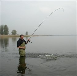
Map with locations for seafishing in the Netherlands
- Details
- Category: Google Maps

Sport Fishing in Fishery Zone, Coastal Waters and Sea Areas. Fishing in the Netherlands does not only take place in inland waters. Sport anglers also fish in the sea, the rules for which vary from those for inland waters.
Read more: Map with locations for seafishing in the Netherlands
Aviation waypoints in Netherlands on Google Maps
- Details
- Category: Google Maps
A waypoint is a reference point in physical space used for purposes of navigation.
Waypoints are sets of coordinates that identify a point in physical space. Coordinates used can vary depending on the application. For terrestrial navigation these coordinates can include longitude and latitude.
Rivers and lakes in the Netherlands
- Details
- Category: Google Maps
These are the main rivers of the Netherlands. All of the Netherlands is drained into the North Sea, partly via the IJsselmeer lake. In the list below, rivers that flow into the sea are sorted following the North Sea coast (including IJsselmeer) from the Belgian border near Knokke to the German border near Emden.
Bathing water quality in W - Netherlands - a data viewer with Google Maps
- Details
- Category: Google Maps
WISE Bathing Water Quality data viewer for a quick check on locations and statistics on the quality of coastal and freshwater bathing waters in The Netherlands.
Read more: Bathing water quality in W - Netherlands - a data viewer with Google Maps
Golfcourses on Google maps
- Details
- Category: Google Maps
The Netherlands provide an interesting alternative for a golf break in Northern Europe. The southern regions of Holland are best equipped to satisfy the needs of visiting golfers.
Tour by bike or E-Trikke around Loonse - Drunense Duinen
- Details
- Category: Google Maps
The Loonse en Drunense Duinen (Loonse and Drunense Dunes) is a national park situated in the south of the Netherlands, between the cities of Tilburg, Waalwijk & 's-Hertogenbosch. It has been designated as a national park since 2002. It is 35 km² (14 mile²) in area.
Read more: Tour by bike or E-Trikke around Loonse - Drunense Duinen
Cycling in towns in the Netherlands
- Details
- Category: Google Maps
The number of e-cyclists in the Netherlands has reached one million in 2012. Ten percent of all cycling kilometres (which total 1.3 billion km per year) are being ridden on pedelecs ....
All hotels in the Netherlands on a map
- Details
- Category: Google Maps
The mapfile is 2 Mb and may load slow - please be patient......
Vertical profile in the Netherlands - related to Google Maps
- Details
- Category: Google Maps
In general the Netherlands are flat and "lowlands". Large part of the country are below the sealevel. Test it in the map and the vertical profile below the map of Holland.
Read more: Vertical profile in the Netherlands - related to Google Maps
Locations to rent a bycycle at public transport locations
- Details
- Category: Google Maps
Rent a bike locations in the Netherlands.
Read more: Locations to rent a bycycle at public transport locations
Hikers cabins in Holland on Google Maps
- Details
- Category: Google Maps
Welcome to the Google Map of the Netherlands Hikers' Cabins Foundation (STN)
KPN WiFi Hotspots in the Netherlands on Google Maps
- Details
- Category: Google Maps
KPN WiFi Hotespots on a map.
Read more: KPN WiFi Hotspots in the Netherlands on Google Maps
More Articles...
Latest articles
- Accommodatie Eurovisie Songfestival 2020 - Rotterdam
- Vermeer - famous Dutch painter from Delft
- Delft - Oude Kerk - Old Church
- Delft
- Enkhuizen - Havenweg - streetview - Google Maps
- Alkmaar - cheese market - Waagplein - streetview - Google Maps
- Hoorn - city center - Roode Steen - streetview - Google Maps
- Veere - Townhall - streetview - Google Maps
- Middelburg - Townhall - streetview - Google Maps
- Vlissingen - Smallekade - streetview - Google Maps
- Zierikzee- streetview - Google Maps
- Oosterschelde- streetview - Google Maps
- Haringvlietdam - Haringvlietsluis - streetview - Google Maps
- Hollands Diep - streetview - Google Maps
- Moerdijk bridges - streetview - Google Maps
- Harlingen - streetview - Google Maps
- Stavoren - streetview
- Dokkum - streetview
- Giethoorn - streetview
- Claire Morgan The Sound of Silence - Noord Brabants Museum
Visitors for Visitholland
We have 166 guests and no members online

