Visit Holland, land of water
- Details
- Category: Geography
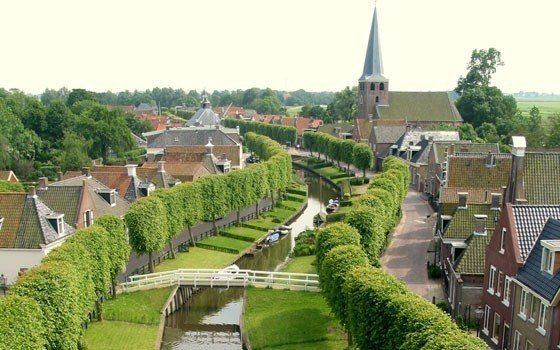
Holland is rich in water and is well- known for its expertise with regards to water management. Due to its location on the north-sea and all the inland waterways, water has also brought Holland a lot of prosperity. It is often said that water is flowing through the veins of the Dutch.
General
 The total size of Holland is 41,500 km2, of which 7,700 km2 is water. The three main rivers (the Rhine, the Meuse and the Scheldt) enter Holland and branch out until they eventually reach the North Sea. Over a quarter of the country is under sea level. The elevation of the land is measured using Normaal Amsterdams Peil (Normal Amsterdam Level) or NAP (0 metres NAP=average sea water level). Nieuwerkerk aan den IJssel at 6.74 metres under sea level (-6.75 NAP) is the lowest point. Amsterdam Airport Schiphol is the only major airport in the world that’s located below sea level (-4 NAP).
Water brings prosperity to Holland
During the Golden Age (the 17th century), Holland evolved into a big seafaring trade power. The famous Dutch East India (VOC) ships were sailing to and fro with merchandise, varying from spices to fabrics. During those times, Dutch cities such as Amsterdam, Utrecht and Rotterdam evolved into big trade centres which were helped by their location on the water. Over time, Holland became an important player in container shipment and transport over water, with the port of Rotterdam now being the third biggest in the world. Dutch infrastructure is not limited to transport over sea but also extends across the Dutch river network, into Eastern Europe. Due to the location of Holland, the fishing industry is also an important sector.
The battle against the water
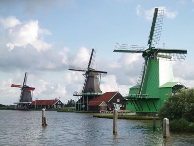
 Throughout the centuries, the Dutch have fought a battle against the water. Farmers controlled the water level on their land using mills. They used dykes in an attempt to keep their feet dry. In the last century, the sea level has risen by 17 cm and it is expected to rise by up to 59 cm in the coming century. During the last flooding disaster in 1953, 8% of Holland was flooded and 1,838 people perished. Since that time, the Delta Committee has been working hard on building flood barriers, dams and dykes to keep the land dry. It is poignant that the motto of the province of Zeeland is ‘Luctor et emergo’ (‘I struggle and overcome’).
Barriers: Places of interest for tourists
There are huge barriers, that have become important tourist landmarks: the storm surge barrier (the Eighth modern Wonder of the World), The Eastern Scheldt Barrier (Neeltje Jans Delta Park), Europort Barrier (Maeslantkering, Hartelkering and Rozenburg dyke reinforcement) and the North Sea Canal. Also worth mentioning is the Afsluitdijk, a 30 km long connection between the provinces of North Holland and Friesland, that separates the IJsselmeer from the Wadden Sea. The dyke now protects large parts of Holland against flooding playing an important role in water management.
Water management remains a focal point for Holland because of climate change and associated global warming and rising sea levels. The newest line of thought is to give water more room, because flooding occurs when water is over controlled.
Water knowledge as an export product
Holland is internationally recognised as an expert in the field of water management. All over the world, Dutch dredging companies (Royal Boskalis, Van Oord) and hydraulic engineers (water consultants DHV, Witteveen+Bos, Arcadis and Royal Haskoning are in the world’s top ten) participate in hydraulic projects; a market that has not yet reached saturation because of climate change and rising sea levels. Dutch experts also provide expert advice with regards to water facilities (drinking water).
The water sector is also involved with innovations in sustainable use of water. Examples are Tulip Island, a wind turbine park in the North Sea for power generation and the Waterfactory in the Dierenpark Emmen Zoo, which is used to recycle water.
Holland, water and tourism
With this much water (both fresh and salty), Holland is perfectly suited for a water sport holiday. Popular options are sailing, boating, windsurfing, kite surfing, diving, angling etc. The most prominent water provinces are Friesland (Frisian Lakes) and Zeeland (North Sea, Lake Grevelingen, Eastern Scheldt). The infrastructure is also perfectly suited for sailing from one town to another, using scenic water routes.
From May 1 until October 1 (swimming season), the provinces measure the quality of officially designated swimming waters.
Events
Each year, the tourist calendar is filled with water related events, including:
• World Harbour Days: ‘Open Harbour’ in Rotterdam
• HISWA on the water: spring and autumn boat shows
• Sneekweek: Sailing event in Friesland
• Vlaggetjesdag: Scheveningen
Attractions
 Water defences around Amsterdam (a UNESCO World Heritage listing consisting of a 135 km line of forts and land that had been inundated in the past) to protect Amsterdam from invaders, are very interesting sights for tourists interested in the Dutch history with water. Delta Works, Verdronken Land van Saeftinghe (Sunken land of Saeftinghe) in the Western Scheldt, Giethoorn (the Venice of the Netherlands), Netherlands Water Museum, Maritime Museum Amsterdam, Maritime Museum Rotterdam, VOC ship De Batavia, Maritime Museum of Vlissingen, Zeeland, and Zuiderzee Museum also explore the country’s history with water.
Accommodation
In Summer 2012, a new unique tourist facility will open at the Wadden Sea: the Waddendobber. This accommodation for four people is located on a sand bank when it’s low tide and during high tide, it floats on the rising water. Other ways to spend the night on the water vary from camping on a raft (Kagerplassen, Utrecht, Biesbosch), and staying in a floating hotel: the Botel (in Amsterdam, Rotterdam, Maastricht and other places).
Accommodation in the region of Zeeland (islands)
Accommodation in the region of the Wadden Sea
Living on the water
In a densely populated country such as Holland, floating houses are becoming more of a serious alternative to urban development. Due to the rising sea levels and increased precipitation, there is a growing need for emergency storage and overflow areas where there is already a shortage of building locations. However, living on the water is not necessarily a new idea. Houseboats were once an affordable housing alternative, but have now become a lifestyle that provides a sense of freedom and closeness to nature. Holland is now organising this on a larger scale: we’re not just building individual houses on the water, but entire suburbs. A few examples: Blauwe Hart in Leeuwarden, Waterwijk in Zierikzee and Terwijde, part of the Utrecht Vinex area called Leidsche Rijn. The Amsterdam suburb of IJburg contains complete floating housing blocks, where jetties act as pavements and squares. Almere is developing Booneiland, with houses designed by Piet Boon.
Latest articles
- Accommodatie Eurovisie Songfestival 2020 - Rotterdam
- Vermeer - famous Dutch painter from Delft
- Delft - Oude Kerk - Old Church
- Delft
- Enkhuizen - Havenweg - streetview - Google Maps
- Alkmaar - cheese market - Waagplein - streetview - Google Maps
- Hoorn - city center - Roode Steen - streetview - Google Maps
- Veere - Townhall - streetview - Google Maps
- Middelburg - Townhall - streetview - Google Maps
- Vlissingen - Smallekade - streetview - Google Maps
- Zierikzee- streetview - Google Maps
- Oosterschelde- streetview - Google Maps
- Haringvlietdam - Haringvlietsluis - streetview - Google Maps
- Hollands Diep - streetview - Google Maps
- Moerdijk bridges - streetview - Google Maps
- Harlingen - streetview - Google Maps
- Stavoren - streetview
- Dokkum - streetview
- Giethoorn - streetview
- Claire Morgan The Sound of Silence - Noord Brabants Museum
Visitors for Visitholland
We have 210 guests and no members online

